

Stroll 1 – Countryside and Coal Mining
Linking the villages and pubs of Stottesdon & Chorley
Distance: 4½ miles or 7km Time: (approx) 2 hours
- For a handy, printable PDF version, click here -
----------------------------------------
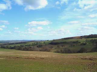
This moderate ‘ramble’, through farmland and tranquil wooded valleys, uses quiet country lanes, ancient footpaths and old ‘roads’. Parts can be muddy in wet weather; there are 13 stiles, 6 gates and 50 steps. It offers great views (west to the Clee and east to Highley, and, over the River Severn, to Dudley) and passes both our village pubs. Enjoy!
Start from either Stottesdon 1 or Chorley 4
1 From the Fighting Cocks take the Bridgnorth Road, past the school and Glebe Drive, to the ‘T’ junction. Turn right – follow the quiet lane to ‘Bellringers Bank’ – and pause for great views, and the sound of skylarks on sunnier days to Harcourt crossroads.
2 Go straight ahead onto the bridleway, pass Upper Harcourt Farm (large dairy herd), descend to bridge over a small stream and up the other side, with new, ‘sustainable’ native species plantation on left.
3 Turn sharp left, down through mature woodland. Beyond the house and garden, just after another bridleway joins from the right, look out for traces of old coal workings in the banks as the track drops down to a stream. Over the bridge, follow the track up to High Green note orange colours in water around the path (a clue confirming the presence of iron ore in the rocks just below the surface).
4 At Chorley Chapel turn left, follow road down to Lower Chorley; then take the left fork into Bakehouse Lane (side entrance to Duck Inn). Continue up Lane, go through metal gate, and join tree-lined old road. At top of hill, path turns sharp right then left, to skirt Chorley Manor (1638); then right onto tarmac driveway for a few metres to waymark post opposite kissing gate in the Cheshire railings on the left of the Lime tree avenue (carpet of seasonal flowers in the Spring).
5 Turn left through this gate and keeping near the hedge (left) drop down Church Field to roadside gate.
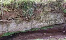
6 At gate, turn left, then right to cross the road and a difficult stile (in the hedgerow before bridge). Take the field path above the stream to cross two stiles either side of a plank bridge (slippery when wet) over small brook. Beyond this, look out for a ‘cliff’ where the stream has eroded softer ground to reveal the underlying rocks. Continue west, over a double stile and on to the next; down steps beyond into a magical glen (streamside wildflowers and mosses) to cross
bridge and climb the 25 steps to a stile above.7 Turn right and follow the field edge (look for signs of badgers and see the deep gully eroded by the stream) to cross another stile into a small wood. The path goes down to a brook and up to another stile. Go straight on to cross two more stiles, with a small bridge between.
8 Ignoring a waymark post uphill on your left, keep to the right field edge until a second post comes into view. Head to this and on up the slope to cross the stile near top right corner of field. Continue west to join the road at next stile (near the large oak by the far hedgerow).
9 Cross road and go through gate opposite. After next gate, turn left onto footpath to the kissing gate into St Mary’s churchyard. Follow grass path across the church yard then the church drive back to Stottesdon centre.
The coal found here is 300 million years old – meaning it was formed 100 million years before dinosaurs roamed the earth – in an era geologists call ‘the Late Carboniferous’. Chorley was then a hot, humid Tropical rainforest, the fallen
trees from which rotted down and compacted to form the Coal Measures.Coal mining started here around 200 years ago and was at its peak in the 1890’s after the nearby Severn Valley Railway opened up new markets from 1862. The Census shows that 17 miners lived in cottages at Midwinters, Chorley and Harcourt in 1891. Trade was evidently good as there was a plan (1907) to build a railway along the valley followed by this walk to carry coal from Chorley to Cleobury Mortimer. Can you imagine how different the valley might look had this line ever been built?
Mining at Harcourt ceased in 1924 and the last Chorley coal workings closed in 1933 – there are few reminders of this industrial past; one is the house at Bagginswood which old miners might recall as ‘The Miners Arms’.


