Stroll 2 – Ducks and Bakehouses
Exploring woodlands, streams and the old main road to Chorley
Distance: 3 miles or 5km Time: (approx) 1½ hours
- For a handy, printable PDF version, click here -
----------------------------------------
This shorter ‘ramble’ uses ancient footpaths, old lanes and short sections of village road. Parts can be very muddy after wet weather. There are 10 stiles, 9 gates and about 20 steps.
Start from Chorley Village Hall 1
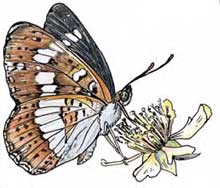
1 Turn down New Road into village, passing Duck Inn (right); bear left by Lower Chorley (magnificent medieval farmhouse); up bank to High Green (woodlands here are an SSSI – protected habitat of rare butterflies, including the White Admiral (once known as ‘White Admirable’) which is here at the northern limit of its range) and the Silver Washed Fritillary.
2 Turn right at Chorley Chapel (built 1878 by local families; well worth a closer look); down lane (50m); bear right (donkeys in paddock, right) down marked bridleway into Lower Cowslow Covert (silver birch, polar and ash trees); over stream bridge (look out for bluebells, honeysuckle and violets in season); up bank to waymark post; turn left, through paddock gateway.
3 Diagonally across paddock to gate into Bragginslye Covert wood - good examples of high oak trees with old stools of hazel below); follow yellow markers through wood (look out for clumps of holly); scramble across stream; up bank to cross stile; bear half-right over field (cottage, once derelict; said to be haunted, right; oak woodland Bush Wood, left) to go through gate at top right corner; turn right onto track.
4 Follow track (wade small ford; through gate/cross stile by cottage). Look out for newly planted native-species hedgerows (conservation and woodland management are high priorities here); poplars and willows in the wetter area near the ford; old apple, fig, and cherry trees near cottage to turn left, through gate, opposite point where track turns sharp right.
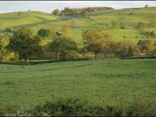
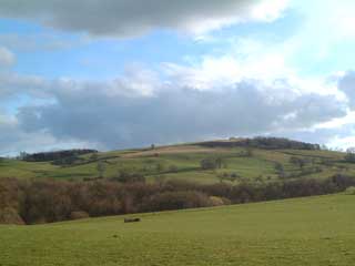
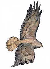
5 Follow fence line 100m (views: Harcourt; Lower Chorley, right; Knowle Hill, left, 754ft [232m] is highest point in parish) to marker post; bear half-right (small stand of silver birch, right; look out for buzzards above) over boggy ditch.Straight ahead to cross stile bottom left field corner; follow stream (right) along edge of next two fields (cross stile between); through gate to track in small shady copse; bear round (right) to bridge.
6 Five footpaths meet here so care is needed to join the correct route: cross stream; through gate; turn half-right to climb up side of hill (stream below, right) pass large field oak to cross stile in hedge bank ahead; head diagonally over next field (cowsheds left) to turn left through gate in far left corner; bear half right over field to cross stile/steps down to track; turn left; follow bridleway for 200m
7 Opposite second gateway (left) to dairy yard, turn right to cross stile (just beyond a field gate) in hedgerow (hedges like this were traditionally “laid” by hand to keep them in good condition; mechanised flailing is used now; since flails do not cut around cable poles, look out for living clues to how high and spindly hedges quickly become if left uncontrolled... now imagine the wholecountryside covered with such growth; a mass of thick, intertwined, prickly bushes – which, before organised agriculture cleared it away, was how the ‘wildwood’ of ancient Shropshire might have looked. Bear slightly right down field to cross next stile (bottom right corner).
8 Down steep bank to cross bridge; turn half left, up steps to marker post; turn sharp right, follow stream (below, right) to cross next stile; ahead along fence through plantation of oak, ash, larch, scots pine to turn left, far right corner of wood.
9 Up hill to marker post; ahead, slightly left, up to next marker; turn half right to cross stile/gap; down bank to turn right, downhill, along old road (‘Bakehouse Lane’ was the main road here before ‘New Road’ was built) to go through gate; straight ahead into village for 200m.
10 Just passed ‘The Bakehouse’ (left), after which the lane is named, turn left; up path, pass The Duck Inn, to New Road; turn left to village hall.
Finding Chorley, on most maps, can be quite a challenge – although the modern village is 1km from end to end, it is unusual in that it is three distinct, older settlements joined together – High Green (around The Chapel) to the east; Lower Chorley (around the farm of that name); and Chorley
(around The Manor house known simply as ‘Chorley’) to the west.

