Stroll 5 – Down the hollow and around the Knowle
Discover the secrets of watercourses, woods and wild deer
Distance: 7 miles or 11km Time: (approx) 3½ hours
- For a handy, printable PDF version, click here -
----------------------------------------
This longer ‘scramble’ uses ancient footpaths, old lanes and sections of country road. Parts can be very muddy after wet
weather. There are 26 stiles and 14 gates.Start from Stottesdon 1 or Chorley 11
1 From the Fighting Cocks, follow Burwarton road (50m); turn left at fingerpost (old village Pound was on this corner); head along Pound Lane passing two cottages (left) to cross stile/gate; down along sunken section, through gate halfway down (ancient holloway worn away over centuries by passing carts and animals, and by water) to bottom of lane.
2 Turn sharp left after gate (take care across corner of busy farmyard, sheep fields beyond); through nearby marked gate; ahead to cross stile; follow hedge (right) to gate; ahead to cross stile/footbridge (Bakers Brook); up bank, cross next stile; turn left, over another stile then follow path (brook left) 150m to cross stile at footpath crossroads (Ginny Hole).
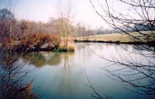
3 Straight on (old trout lake, right; brook below, left. Water was pumped from here to holding tank in village before mains water supply connected) to cross stile; ahead to top corner of pasture; cross two stiles; on up to turn half right at
second marker to cross stile (right of cottages ahead).4 (The next path section is 750m – modern road is 1km for same journey!) Cross road, turn left; at road junction (100m)
turn right up steps to cross stile behind road sign; diagonally over field to cross stile just below farm; through marked gate; along garden fence to cross stile; straight on to top left corner of field, to cross stile/ditch onto the Cleobury road.5 Turn half right to cross road then stile opposite; over field to cross next stile; down (follow hedge/stream gully, right) to next stile/bridge in spinney bottom right corner of field; up to cross stile at top of bank.
6 Turn right to cross next stile; head to far bottom corner of field (keep stream which has eroded a deep gully right for next 400m, through this and three more fields); cross stile/bridge; through sets of gates (used for sheep pens); straight ahead to far right field corner to cross next stile/bridge /stile (look out for the ‘cascade’ where tiny brook has washed away all the soil to expose the underlying rock; harder rocks, less easily eroded, mean there is a waterfall on main stream to right); up bank and continue 150m along to a stile (right) in field/ stream boundary.
7 Do not cross stile; turn half-left uphill then follow hedgerow up to line of oaks beyond top of the hill (views towards Abberley, right); at opening keep trees left; ahead through double gate; turn left into yard; follow track round to pass farm/cottages; then turn right onto road for 30m
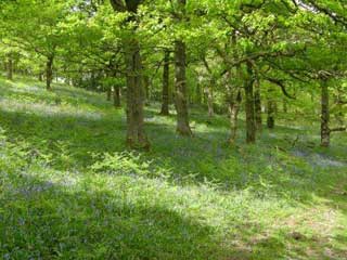
8 Leave road at Bridleway sign, turn left into wood Birchen (‘birch tree’) Park; next mile (crosses ancient boundary with Kinlet parish four times) passes through pheasantries (dogs under close control please). Pheasants, though now a common sight, are not native birds but were imported from central Asia about 1000 years ago. Keep left at junction (250m); left again (in 300m) on path to wood edge; through gate; follow left boundary to top right field corner.
9 Through gate (views over Kinlet Hall and its Park -the original Hall was demolished in Georgian times to put an end to the haunting ghost of George Blount, the squire who had died in 1581); down to turn right on track at edge of Gorsty (“prickly shrub or gorse”) Park wood; turn left (100m) at gateway; through wood; cross track, stream at bottom; up far bank to field;turn left, over gate (30m); then sharp right to follow fence (right) down to cross stream/stile, then up along
the deer fence which surrounds this part of Bush Wood to cross/turn right at double stile10 Farm (left), named ‘Mass House’ around 1800, recalls outlawed church services held in secret; house is believed to have once had a ‘priest hole’. Diagonally up ridge (views (left) to highest point in this parish – Knowle Hill 754ft (232m); through gate below; across next field to cross stile to track; turn left to bridleway gate (right); ahead (cottage left) to cross next stile into wood (Bragginslye Covert); scramble across stream; follow yellow markers to gate; diagonally across paddock to join track by garden
11 Turn left at Bridleway junction; follow marked track 1 mile, through wood and up hill beyond, to Harcourt crossroads; straight ahead for 1 mile along lane to ‘T’ junction at edge of Stottesdon; turn left; follow road passed School and round to village centre; Fighting Cocks on left.
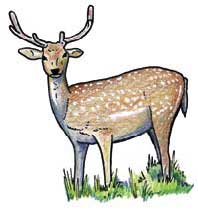
The word ‘park’ now usually means a playground, or urban green space – this walk has examples of two older meanings: the formal, landscaped ‘parkland’ around Kinlet Hall; and the woodland ‘parks’ (like Gorsty Park) nearby. These woods were once enclosed by wooden fences (‘pales’) and were used for keeping fallow deer; those fences are long gone and most of the remaining deer here, and in the Wyre Forest generally, roam more freely – shy, timid creatures… so go quietly if you hope to see them!

