
Stroll 6 – Over Ridge and up the Rea
Exploring Drove roads, the poet’s river, and ‘The Gadget’
Distance: 4½ miles or 7km Time: (approx) 2½ hours
- For a handy, printable PDF version, click here -
----------------------------------------
This moderate ‘scramble’ uses ancient footpaths, green lanes and short sections of country road. Parts can be very muddy after wet weather; there are 9 stiles and 8 gates. Climbing to 657ft (202m), it has stunning local views over the Rea Valley and for over 20 miles across Worcestershire to the Malvern Hills.
Start from Stottesdon 1
1 From the Fighting Cocks, take the Cleobury Mortimer road for 400m; turn right at footpath sign and follow the gravel track downhill (keep a sharp look out - vehicles and horses also use this narrow lane) to a path ‘crossroads’ beyond the stables and bridge over stream (Bakers Brook) at ‘Ginny Hole’ (‘Jenny’s Hole’ 1846).
2 From signpost, follow track (ahead, slightly right) up to gate and cross a stile. Take left-hand path down across the horse grazing field to next stile and then go diagonally up the hill (house on right) to and through the double gate, onto road, in top corner of field (like others, this large field is an amalgamation of several old, smaller, fields to create the space required for mechanised arable farming). Cross road, turn left: 100m on, turn right over stile (fingerpost opposite) to join path, by field edge, up the bank to a marker post.
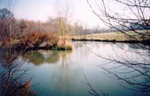
3 Turn right at post; through metal gate and straight-on up to the earth banks of a substantial man-made pond - which teems with dragonfly and other wildlife in summer. This is the highest point on the walk so pause to take in the views (West - Rea Valley, immortalised by Simon Evans - postman/poet/ broadcaster from Cleobury Mortimer) and Clees beyond; south- to Abberley and the distant Malvern Hills; north- back over our route from Stottesdon). The waymarked path continues passed two conifer-hedged shooting ‘hides’ then hugs the field edge round and down the slope (small wood plantation to the right)
4cross stile (observe gate* in far left corner of field) – head diagonally down and then up the slopes to cross another stile (to right of gate*) leading to another path ‘crossroads’. Turn right by the bench (imagine how different the scene might have looked, and smelt, 100 years ago, with herds of cattle and sheep being driven along the treelined lane to the weekly market in Cleobury).
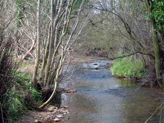
Follow lane uphill and down, through a bridleway gate, to Prescott in 700m (Sandstone rock-faces visible near the end of this section are over 300m years old - ‘Upper Devonian’ in geologist-speak) and this is the legally protected ‘Prescott Corner SSSI’ where pre-historic fish-fossils have been found.5 Keeping a sharp lookout for traffic on blind bends join narrow road – turn left for short ‘detour’ downBack up the hill; follow road round to second bend, turn half-left and ahead to gravel track downhill, straight passed Prescott Cottage and old Nursery(right), and motor-workshop (left); track reverts to muddy lane ahead. Follow round to left (crossing indistinct line of old railway), then through gate and across river on stone bridge known locally as ‘The Roman Bridge’ since it is very old (in reality it is probably 400 years young!) – notice the size/solid construction, confirming that this was once a major highway (the modern road has a ford crossing, not an expensive bridge, over nearby Farlow Brook).
6 Turn right over stile on far side; take footpath through 3 fields (over two stiles close to farmhouse); join road at next stile; cross the Rea (Hardwick Bridge – near site of old iron forge); round corner to former rail crossing (listen carefully for the sound of ‘The Gadget’ 1908 steam train rumbling towards the ungated road crossing – or maybe it’s just the whistling wind in the trees and the sheep bleating?) then up Day House Bank to sharp left bend beyond farmyard (‘Dey Hus’ – OEDairy Farm).
7 At signpost on bend leave road to follow marked bridleway leading straight back to village (this ancient holloway is much more direct than the modern road, though springs just below ground mean it is often much muddier!) passing through a busy sheep farm-yard (between the first two of five gates) before scrambling up ‘Pound Lane’ (a reminder of the stone built lock-up (‘pound’) for stray livestock which once stood by the lane’s far end) to hill-top Stottesdon (160 feet (50m) above the Rea). Turn right at the road (‘High Street’) and The Fighting Cocks is just ‘three doors down’…

